
1
of
11
Loading...
Delaware River Maps
$800
Unit price
/
Unavailable
Taxes, discounts and shipping calculated at checkout.
Delaware River Maps - West Branch is backordered and will ship as soon as it is back in stock.
Couldn't load pickup availability
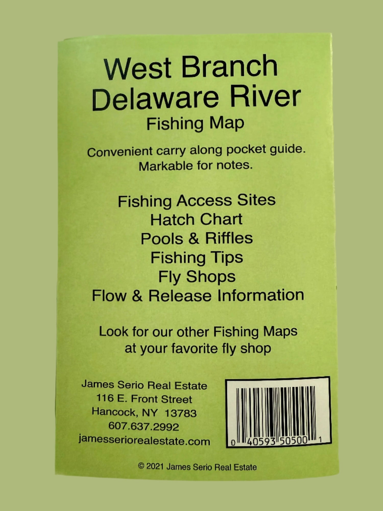
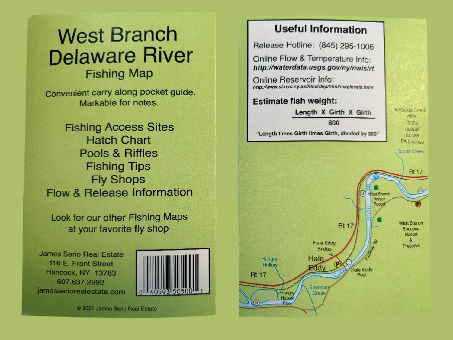
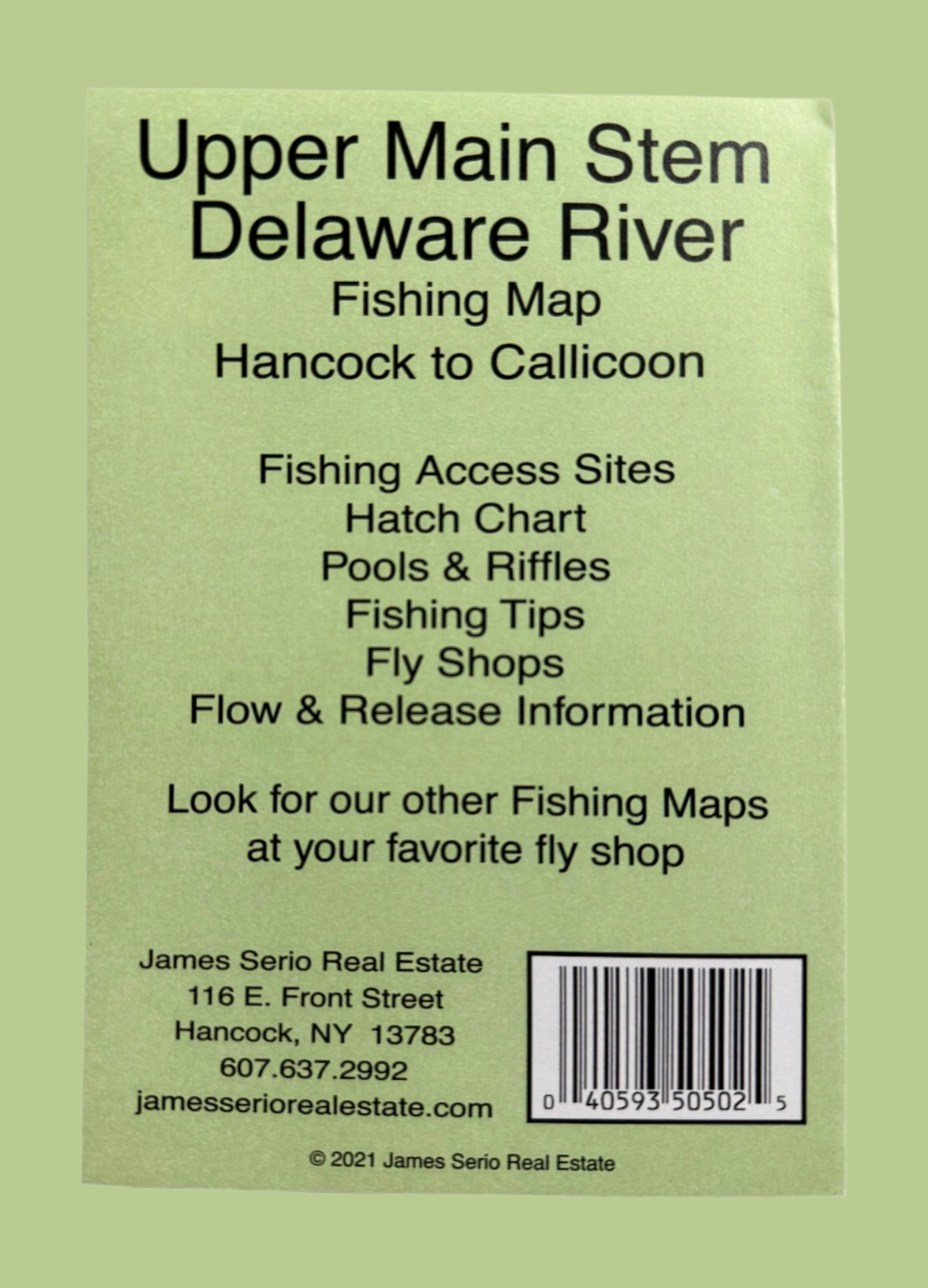
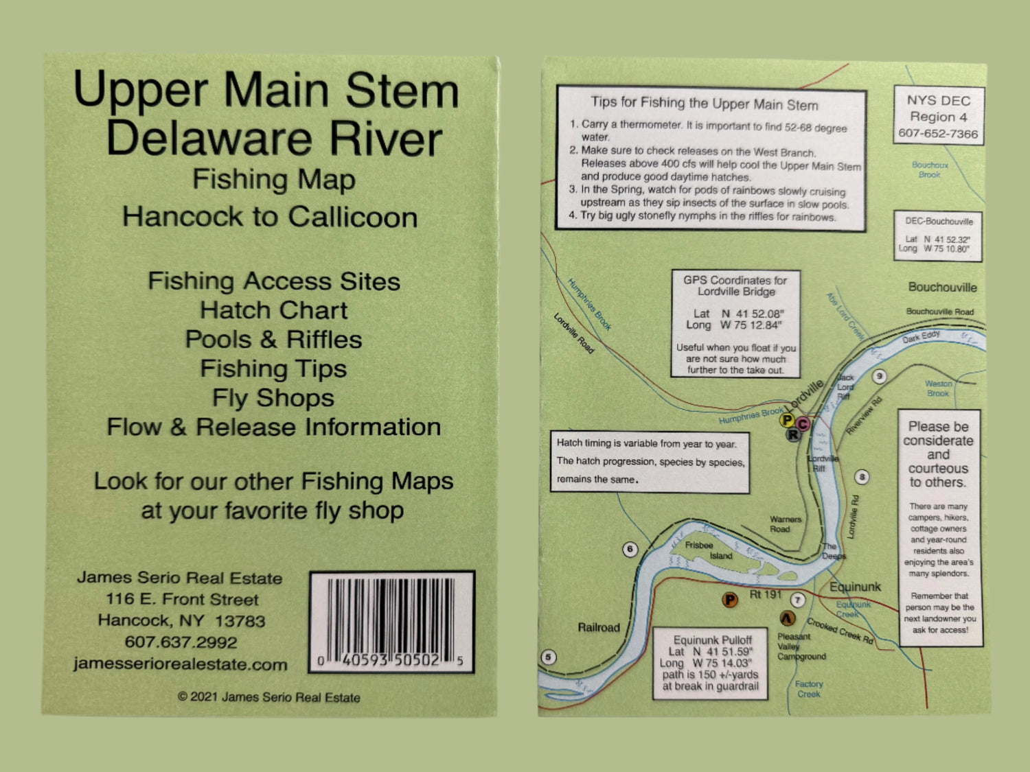
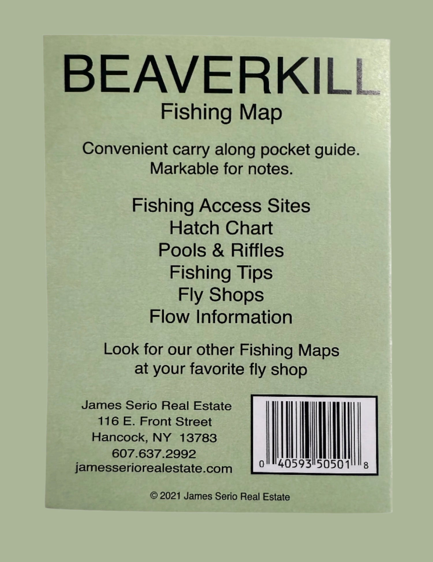
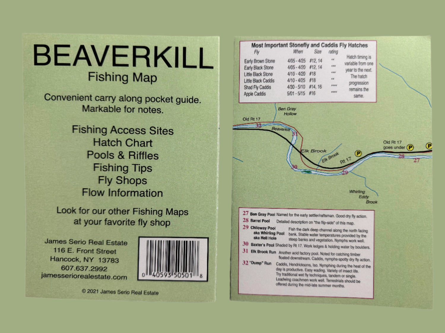
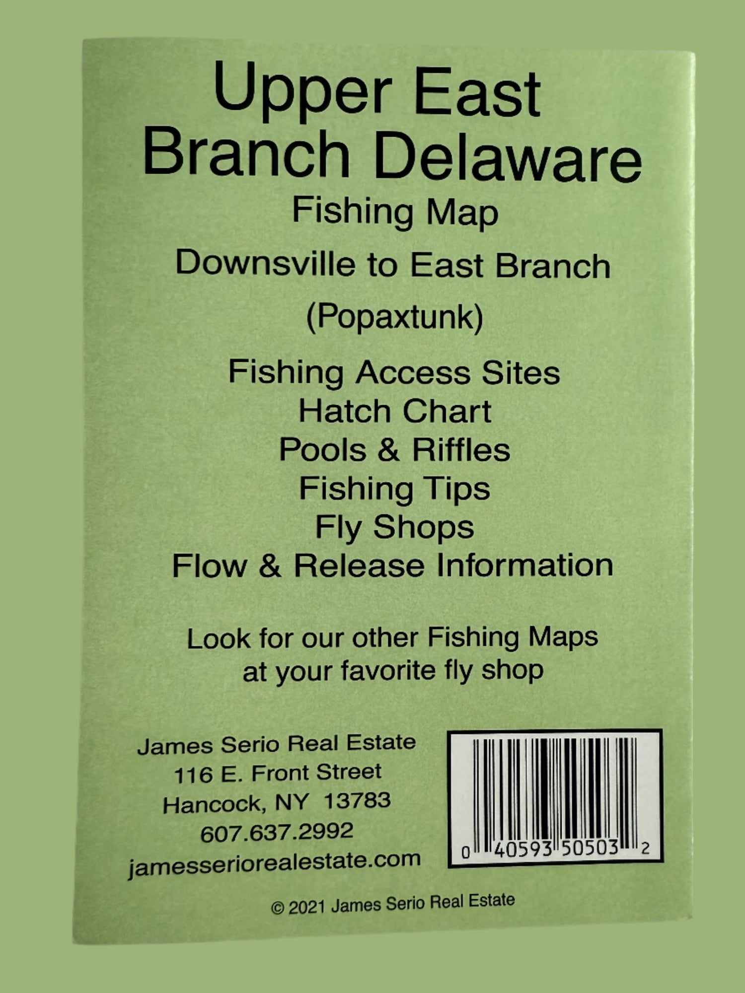
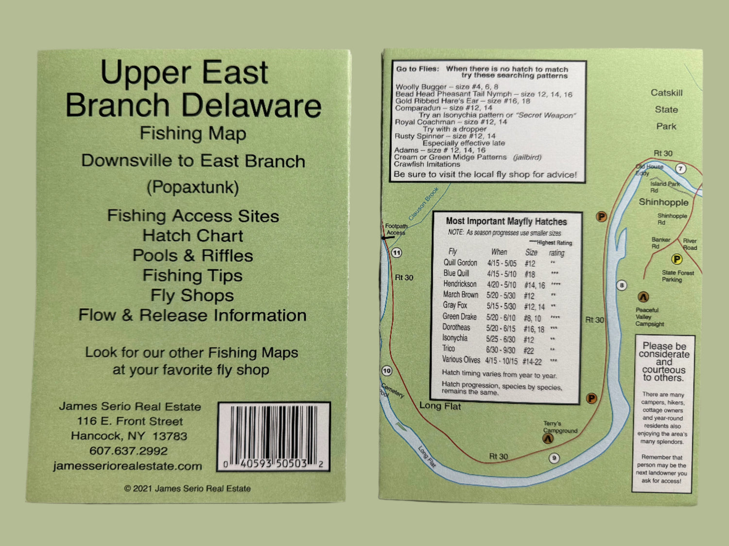
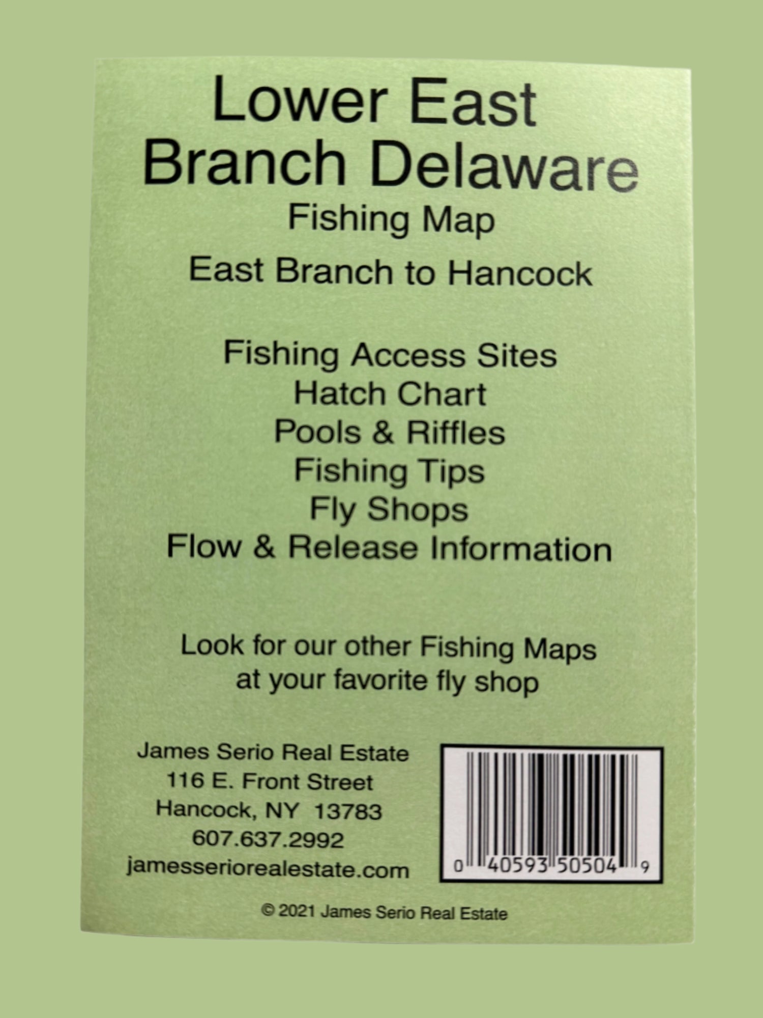
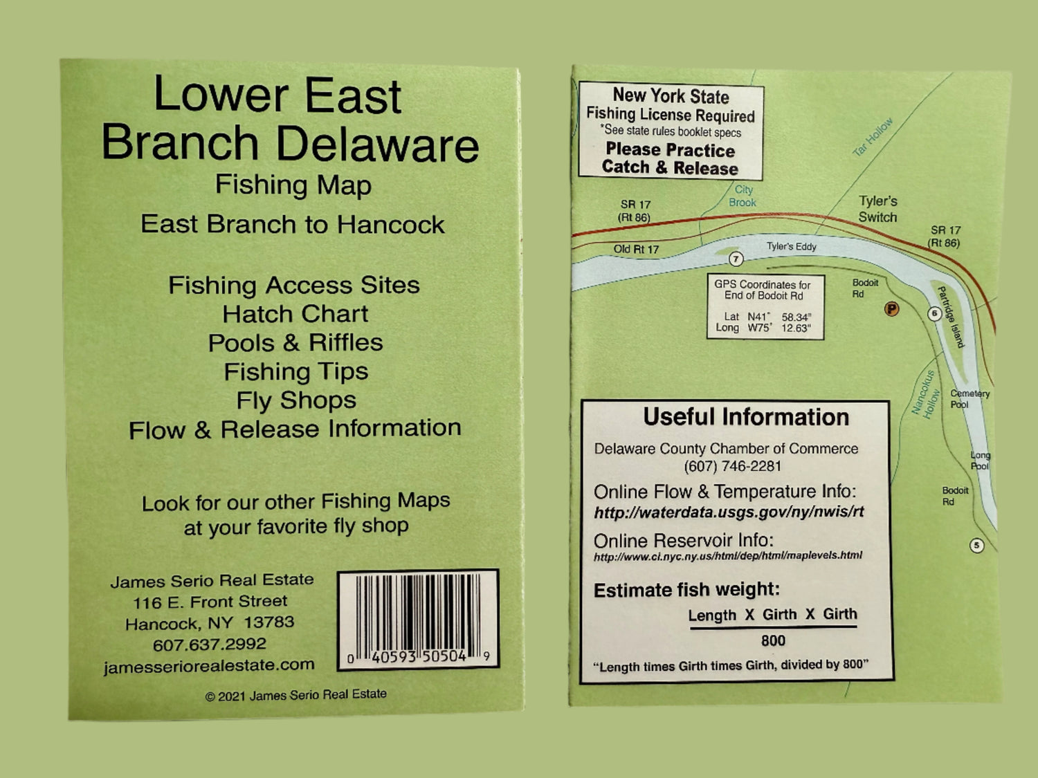
Water resistant maps of the Trout fishing sections of the Upper Delaware River System, West Branch, Upper Main Stem, Upper East Branch, Lower East Branch, including the Beaverkill.
Showing:
- Public Access,
- River Miles,
- Riffle and Pool Names,
- and other Points of Interest.

Delaware River Maps
$800
Unit price
/
Unavailable